Advertisement
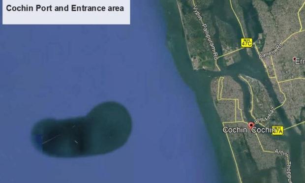
According to a report, the formation is mostly about the size of West Kochi. It was also found that though the Google Earth image shows the presence of the structure, its physical presence cannot be seen.
The image was shared by a Facebook user, KX Julappan, who is the president of an organization named ‘Chellanam Karshika Tourism Department’.
Related Articles
Advertisement
K. Riji John, the vice-chancellor of the university said, that looking at Google Maps, this looks like any other underwater island that we see across the globe. There have been similar observations, and there is a specific also for this. But, we do not know what it is made of- whether it is sand or clay and whether it is distributed regularly.
Further adding that the fishermen on the state’s coastline have complained about dredging by the port in Kochi. However, more information is yet to be looked at in order to really ascertain this.
John asserted that normally, processes like accretion or erosion of the coast are observed due to underwater current, littoral draft.
Accretion is when the sediment comes back to the coast and is a common phenomenon that occurs in the Southern part of the state.